Hiking Trails in Bremen and the Surrounding Area
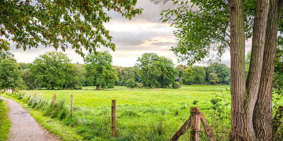
© WFB - Tank
Grab your backpacks, sturdy shoes, some provisions and set off to discover the most beautiful hiking trails in Bremen and the surrounding area. In our tips you will find some routes and areas that are well worth hiking. Your hiking heart is sure to beat faster here.
1. Huntepadd
Starting Point: Karkbäk 15, 27801 Dötlingen
The almost seven-kilometre-long route takes you along the Hunte through the Wildeshauser Geest. You will cross an old beech forest, walk along a heath area and let your gaze glide over the impressive steep bank. On your tour, you will pass by old mounds and large stone graves and learn more about the life of the Glaner Bride. On your hike you will also discover a 1000-year-old oak tree and can take a short break at one of the many rest stops.
2. Ahlhorner Fischteich-Weg
Starting Point: Am Karpfen, Baumweg, 49685 Emstek
On the five-kilometre-long hiking trail you will cross the north-western pond area of the Wildeshauser Geest. On the long sandy paths you can admire gnarled old oaks and let your gaze wander over the various ponds. An observation tower awaits you at the church pond, from which you can observe water and reed birds. If you want to extend your route, you can also make a short detour to the Wildeshauser Urwald (Wildeshausen primeval forest), which borders directly on the circular route.
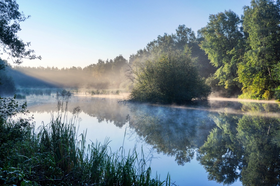
© Hans-Jürgen Zietz - Zweckverband Naturpark Wildeshauser Geest
3. Neuenburger Urwald
Starting Point: Parking Space Oldenburger Str., 26340 Zetel
The nature reserve between Zetel and Bockhorn offers a green home to various plant and animal species on 24 hectares. Winding paths, 800-year-old trees and an old hunting lodge await you in the midst of the flora and fauna of the Frisian south country. With the help of a junction system, all the hiking trails are linked together, so you can find your way around the green oasis even without a map. There are parking spaces on Bockhorner Straße and Urwaldstraße from where you can best start your exploration tour through the primeval forest.
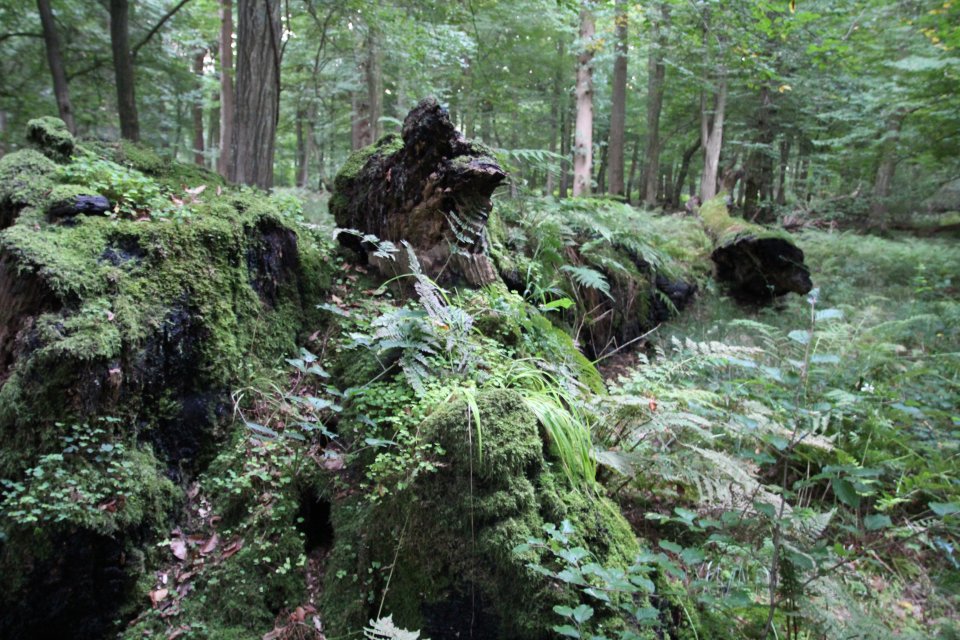
© Neuenburger Urwald - Landesforsten
4. Urwald Hasbruch
Starting Point: Parking lot, Am Forsthaus, 27798 Hude
If you decide to hike in the primeval forest Hasbruch, you will be hiking on historical ground. The forest has been growing there for at least 2000 years. This makes it one of the oldest in Germany. Although today it consists almost exclusively of oaks, there are some ancient oaks that have been there for several years and are therefore considered natural monuments. On your discovery tour you will come across a twelve-metre-high wooden tower that gives you a great view over the treetops and the meadows with streams.
5. Schönebecker Auetal
Starting Point: An der Aue, 28757 Vegesack
The Schönebecker Auetal with its many lawns and small forests stretches out on the edge of Vegesack. You can discover various species of birds, insects and plants on the large green area with its adjacent lake. Highlight on your hike in the north of Bremen: Schönebeck Castle. While the hiking trails lead you directly past the former castle complex, the surrounding greenery sets off the baroque building in a charming way. The historic building now houses a museum. You can access the Schönebecker Auetal between "An der Aue" and "Auf dem Krümpel" as well as via the direct entrance to the castle on the street "Im Dorfe".
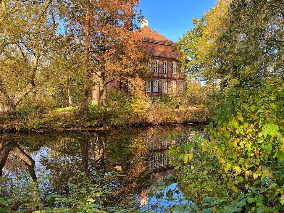
© WFB / JUA
6. Elsflether Sand
Starting Point: Parking Lot Hinter dem Deich, Am Weserdeich 76, 26931 Elsfleth
If you like a bit of maritime flair and a stiff breeze on your hiking trips, the Weser peninsula between the Weser and Hunte rivers is just the place for you. An extensive sandy beach, pastures and dikes await you. You will be greeted at Elsflether Sand by cows, sheep and cattle grazing on the dikes. The kilometre-long sandy beach is perfect for taking a break from hiking, admiring the passing boats or dangling your feet in the water.
7. Nature reserve Luneplate
Starting Point: Parking lot Ehemalige Hofstelle (Infopavillon Luneplate), 27612 Bremerhaven
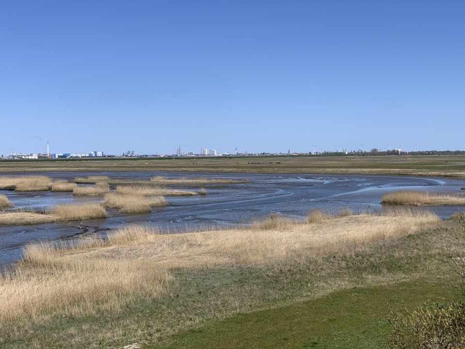
The nature reserve in the heart of the fishing harbour is home to water buffalo, Galloway cattle and various bird species. You can walk along various circular routes through the extensive area in Bremerhaven, which consists mainly of marshland grassland and mudflats. On your hike you will pass pavilions, an observation tower and an observation hide from where you can best marvel at the wildlife. In the winter months, over 10,000 birds use the lune plateau as a resting and roosting place.
© Jan Rohrbach/Erlebnis Bremerhaven
8. Heiligenberg Bruchhausen-Vilsen
Starting Point: Klusterhof, Bremervörder Str. 50, 27432 Basdahl
The climatic health resort in Lower Saxony has a total of 40 km of hiking trails ready for you to explore the diverse nature and hilly landscape around Bruchhausen-Vilsen. On various routes you will discover an old monastery with a water mill, an old castle, as well as panoramic views, former sand caves and holy graves. For the way back, you can use the museum railway between May and October.
9. Nordpfad Hölzerbruch-Malse
Starting Point: Klusterhof, Bremervörder Str. 50, 27432 Basdahl
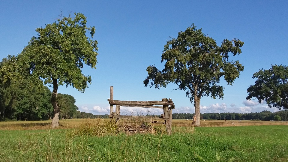
The Nordpfad in the district of Rotenburg (Wümme) was awarded the "Traumtour Wanderbares Deutschland" (Dream Tour Walkable Germany) quality trail designation in 2019. Here, flat paths lead you through large stretches of unspoilt nature. You will pass through secluded forests, marshlands and lowland streams. Walk along the still narrow Lune and Geeste rivers and discover the "Blaue Leiter" landscape and sculpture garden. If you want to extend your 13.4 km route, you can also reach a small game reserve with a petting zoo in Hipstedt.
© Touristikverband Landkreis Rotenburg
10. Kulturland Teufelsmoor
Starting Point: Railway Station Oldenbüttel, 27729 Hambergen
North of Bremen is the Teufelsmoor nature reserve with its impressive moorland landscape. Here you can explore the Hammen lowlands and hike over the flat hills of Bremen Switzerland. On the 14-kilometre-long circular trail "The Two Moors" you can discover the diversity of this special landscape and learn more about peat cutting. In the adjacent local history museum, you can learn more about the work farmers used to do in the moor. The route then takes you to the Hamberg Moor. There you can let your gaze wander over the beautiful moor lakes and, with a bit of luck, discover iridescent dragonflies and lizards.
11. Jakobsweg Bremen
Starting Point: Pilgrims' Hostel, Katrepeler Landstraße 9, 28357 Bremen
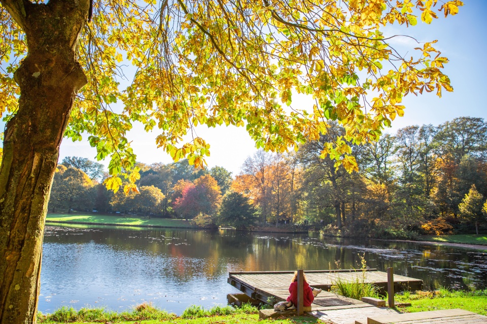
Those who walk the Route of St. James should find their way to themselves. If you also want to go on a little journey, you can do so directly in our Hanseatic city. Part of the Via Baltica pilgrimage route leads directly through Bremen. The section begins at the pilgrims' hostel in Borgfeld. On your route you will pass the Bürgerpark, go through the Friedenstunnel and reach Bremen Cathedral. There you can also pick up a pilgrim's stamp. The route then takes you out of the city via the Werdersee lake and towards Weyhe. The Bremen section ends at Bartholomäus Church in Barrien after a total of 22.91 km. Whether the section is enough to find itself is up to you.
© WFB / Carina Tank
12. Langwarder Groden
Starting Point: Am Kutterhafen, 26969 Butjadingen-Fedderwardersiel
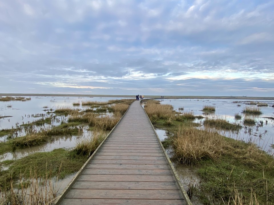
On the North Sea peninsula of Butjadingen, the four-kilometre-long circular trail stretches through the middle of the Wadden Sea. On your hike across the foreshore, you will learn more about the formation of salt marshes, the local flora and fauna and the influence of high and low tides. A long wooden bridge leads you directly over the Sieltief and into the middle of the UNESCO Wadden Sea World Heritage Site. From here you can marvel at the tides and nature at close quarters. With a little luck, you may spot various migratory birds or even seals, depending on the season.
© WFB - LRU

Our Tips on Komoot
You can also find all the tips and other routes on Komoot to hike and find your way around! We hope you have fun discovering them.
© fotolia / _jure